WONDER(O)US Studio
Client: Wonderous Studio
Program: Premium kitchen, home-atelier studio & rental lounge
Location: Yeoksam-dong, Gangnam-gu, Seoul, Korea
Role: Place development, interior architecture, branding, construction & operations planning
Status: Completed / In operation
Year: 2024–ongoing
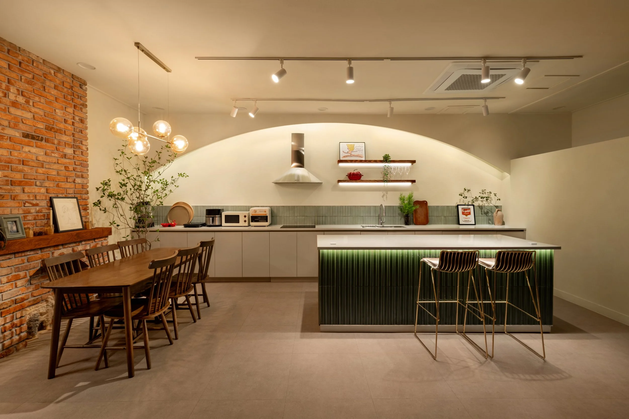
Wonderous Studio is COL.C’s self-initiated project: a New York–inspired home atelier in Gangnam where people can gather, discover their inner wonder, and beautifully document these moments. The brand reinterprets New York’s artistic glamour as a small urban “living room” for the city—a place for magical conversations between strangers, creators, and brands.
The space is organized into four clearly defined yet seamlessly connected zones:
1. Kitchen – a generous main kitchen paired with a 360-degree island, designed for cooking classes, chef’s tables, and food-focused video shoots and livestreams.
2. Dining – a long-table dining zone with a brick fireplace backdrop, offering a warm, cosy atmosphere ideal for mukbang-style content and intimate dinner gatherings.
3. Art Lounge – a talk-show-ready corner layered with artworks, bookshelves, and a gradient of brick and orange tones, suited to interviews, casual conversations, and relaxed discussion programs.
4. Seminar Lounge – a deeper, more grounded zone anchored by black leather sofas, designed for founder talks, brand keynotes, panel discussions, and other content that requires a more serious, weighty tone.
At approximately 132 m² (40py), Wonderous Studio is significantly larger than a typical single-set content studio. The four zones sit within one continuous open plan, so the space can shift easily between film set and event venue, accommodating 50+ guests for product launches, corporate receptions, or year-end gatherings. A high-performance piano, microphones, speakers, and projector support small concerts, talks, and screenings without additional AV build-up.
The visual language combines a contemporary Mediterranean palette with mid-century touches: a signature green fluted island against textured brickwork, warm and soft fabrics, and an arch-shaped ceiling niche with integrated lighting. Layered pendant and track lights create a gentle, even glow over the kitchen and lounge, giving the studio a cosy yet polished atmosphere that reads cleanly on camera while remaining comfortable in person.
As a culinary-themed social hub, Wonderous Studio is designed to handle a wide spectrum of use: from seated dinners and standing receptions to casual networking around the island. The same spatial framework supports YouTube and broadcast shoots, lifestyle photography, chef-led content, high-end corporate events, client appreciation evenings, and small team offsites. As an ongoing “living lab” for COL.C, the project demonstrates how a compact urban space can be simultaneously shooting-ready, event-ready, and emotionally resonant.
A Post-Pandemic Seoul: Future of Urban Logistics
코로나 이후의 서울: 도시물류의 미래
Program: Research Publication Location: Seoul, Korea Team: COL.C, Soyoung Kim Year: 2021
The research envisions how the urban logistics system can be integrated and innovative to achieve sustainability. Through investigating existing logistics infrastructure, the paper contains developing potential value of the existing system and demonstrating a suggestion that the existing system can be advanced in a holistic way.
Future urban logistics should be able not only to deliver goods fast and on-time, but also to execute environmental friendly methods for sustainable development. Moreover, logistics as public service should be available for the people to get their daily necessities beyond nurturing a profitable logistic and distribution industry. This is because reliable logistic service contributes to an aspect of achieving social equality and stability.
Networked micro fulfillment centers as a prototype proposed in the research takes the role as a multi-modal logistic node, a community hub, and a procurement center of public goods.
Youngjoo Bandabi Alcove Gymnasium
YB Alcove Gymnasium | 영주 반다비 체육센터 설계공모
Client: Yeongju City Government Program: Multi-purpose Gym Location: Yeongju City, Korea Team: COL.C, Sungjin Kang, Eunkang Koh Year: 2021
The site is located where the outdoor basketball court and the parking lot area are located at the northern end of the Yeongju Citizens Sports Complex. Although the project site is physically close to the Gaheung 1-dong residential area, there is no direct pedestrian/vehicle connection from the residential area to the site. Besides, the site is not well recognized and accessed easily since the site is situated between the Yeongju gymnasium and Indoor Swimming Pool.
The proposal is designed for reinforcing the northern node of the Yeongju Citizens Stadium Complex by establishing direct pedestrian and vehicle connections from the residential area through Daehakno153beon-gil. Along with the access, a landscaped rooftop is provided for visitors to feel invited and to use daily. Also, It is planned for enhancing openness and visual recognition at the ground level of Yeongju Citizens Stadium where the flow of existing major visitors is generated.
Compact common spaces along the movement of people are deployed in the building. It enables a higher utilization rate of the facility for sports activity as well as for everyday relaxation. Moreover, this could contribute to raising communication between communities and heightening everyday sports culture.
The space is laid out for creating a bright and pleasant space while enjoying and resting throughout sports activities. Differently controlled natural light directions and illuminance implemented such as skylights, north windows, and south ventilation windows. Effective circulation of users is introduced while accommodating access and space for the handicapped.
Yangyang Naksan Residential Complex Development Proposal
양양 낙산 도시개발사업 제안
Client: GKD Corporation Program: Mixed-use Location: Yangyang, Korea Team: COL.C, GK Architects Status: Proposed Year: 2021
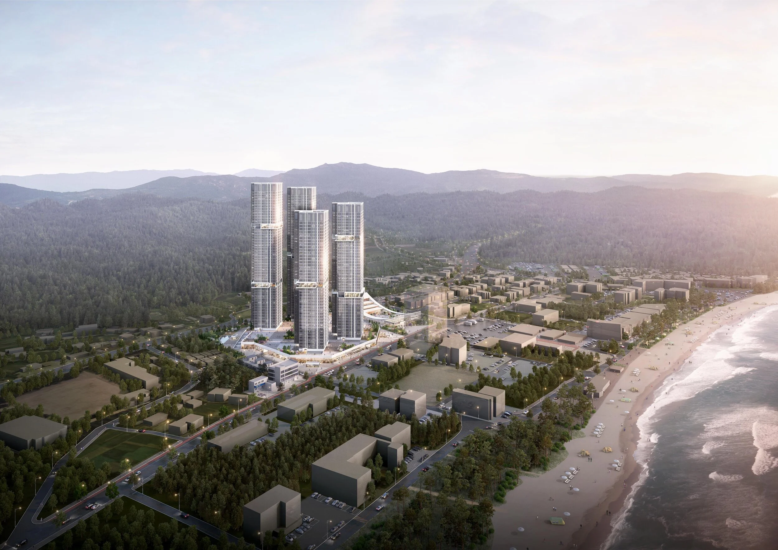
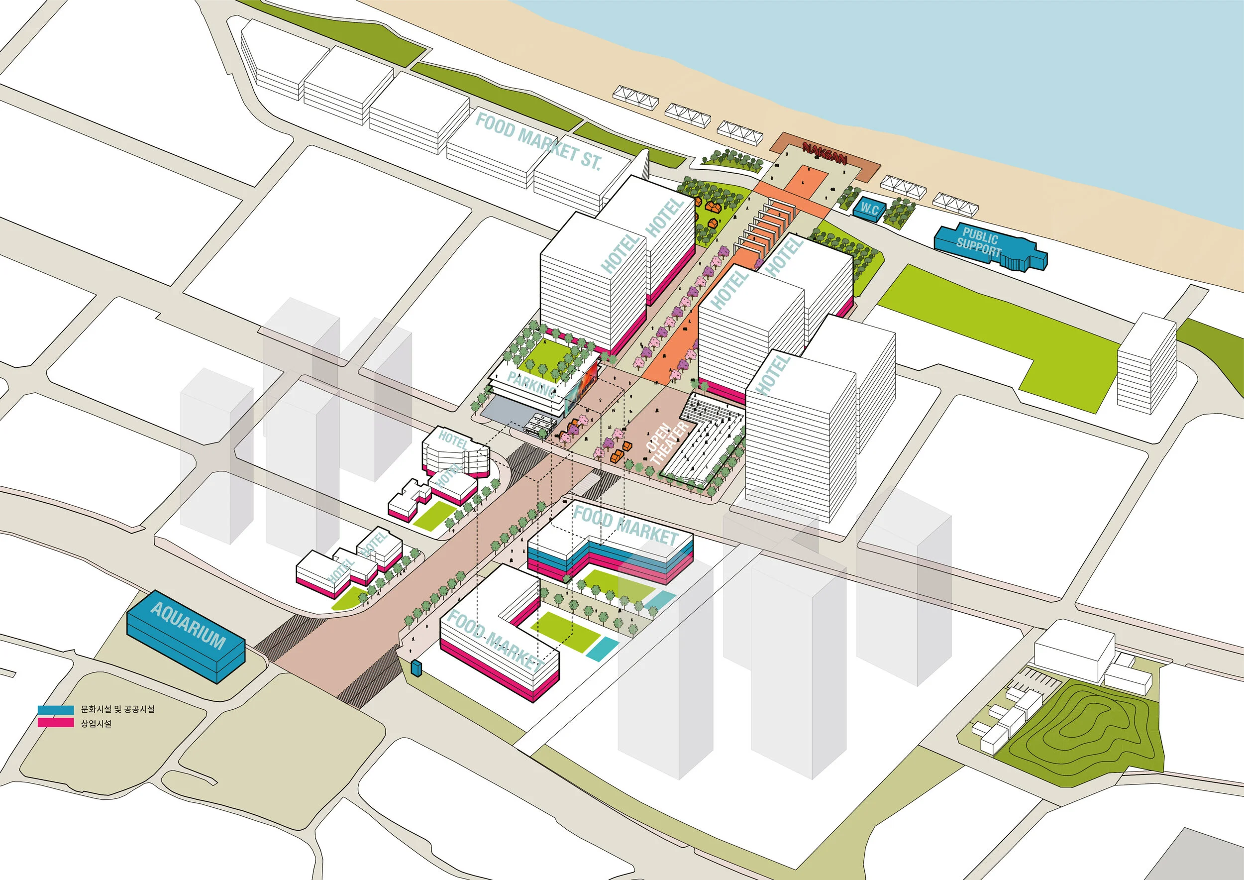
The project site is located on the Culture-Tourism axis of the Naksan district. The goal of the project is to transform the site into an attractive place with branding space stories in the Naksan district of Yangyang. Cultural, commercial, and entertainment programs are introduced to create synergy with the Naksan district tourism.
The complex consists of accommodation, commercial facilities, and residential with an ocean view. The lower floors are composed of street malls, cultural spaces, and public spaces, and the upper floors are intended to provide luxurious second housing and accommodation facilities.
Naeseo Joongri Public Parking Building
JUNGRI STUMP | 내서 중리 공영주차타워 설계공모
HONORABLE MENTION
Client: Changwon City Government Program: Public Parking Building Location: Changwon City, Korea Team: COL.C, GK Architects Year: 2021
Nestled at the end of Hwagaesan Mountain, the area around Naeseo-Jungri is a quiet village with local street shops and mid-rise residential buildings. The existing public parking space adjacent to the Naeseoeup Public Health Center and the Administrative Welfare Center is used as a parking lot and as a main open space in the village. This project site has provided a resting stump to take a break for people visiting nearby shops and public facilities, using public bicycles and taking a walk in the neighborhood. It contributes to strengthening community bonds.
The proposed parking building is designed as a stump-like place so that the locals can continue to use it for parking and comfortable street space in this neighborhood. And, this proposal accommodating a higher parking capacity secures pedestrian safety on the street by accommodating local street parking.
This proposal was awarded as an honorable mention.
Yangyang Naksan Landscape Management Plan
양양 낙산해변 활성화를 위한 경관관리 방안 제안
Client: GKD Corporation Program: Mixed-use Location: Yangyang, Korea Team: COL.C, GK Architects Status: Proposed Year: 2021
After the designation of Naksan Provincial Park was lifted, the Naksan District opened various opportunities for development and regional revitalization.
The Naksan District faces National Route No.7 to the west, Naksansa Temple to the north, Naksan Beach to the east, and Namdaecheon Stream to the south. In this district, there are exquisite natural landscapes in harmony with the sea pine forest, sandy beach, beachfront, and the East Sea, and infrastructure such as various commercial facilities, plazas, and public parking lots. An integrated district's landscape management strategy is required to increase the value of the landscape assets of the Naksan district.
The two major flows that lead directly from National Route No. 7 to Naksan Beach start at Provincial Park Three-way Intersection and Josan Three-way Intersection, and each flow has a different surrounding context.
The flow that starts at the Provincial Park Three-way Intersection starts from the projected site of the Yangyang Aquarium and continues to accommodation facilities, public parking lots, Naksan Plaza, and the sculptures at Naksan Beach. The flow that starts at Josan Three-way Intersection goes through Sea Pine Forest and connects public parking lots and automobile camping grounds. These two main flows which cross east and west are set as the empirical landscape axes, and the framework of the entire landscape is constructed with the east-west two flows and three circulation flows traversing north and south. Starting with two differentiated landscape axes, the monotonous Naksan Beach landscape is induced to transform into a colorful and distinctive landscape.
The axis starting from Provincial Park Three-way Intersection is set as the Culture-Tourism axis, and the space along the axis is reinforced by adding cultural and entertainment space programs that were lacking in the existing Naksan district. Through active infrastructure development, various branded spaces can be provided to attract visitors and to enhance the cultural living environment of the residents in the hinterland.
Another axis, starting from the Josan Three-way Intersection, is set as an Eco-Tourism axis to provide a quiet and peaceful natural landscape for relaxation. It aims to create a space for leisurely recreational tourism by revitalizing the abundance of the existing Sea Pine Forest and reorganizing the outdated infrastructure.
Korea University Medicine Wellness Center Feasibility Study
고려대학교 의료원 웰니스 센터 사업성 검토
Client: Korea University Medicine Program: Hospital Location: Seoul, Korea Team: COL.C, GK Architects Status: Proposed Year: 2020
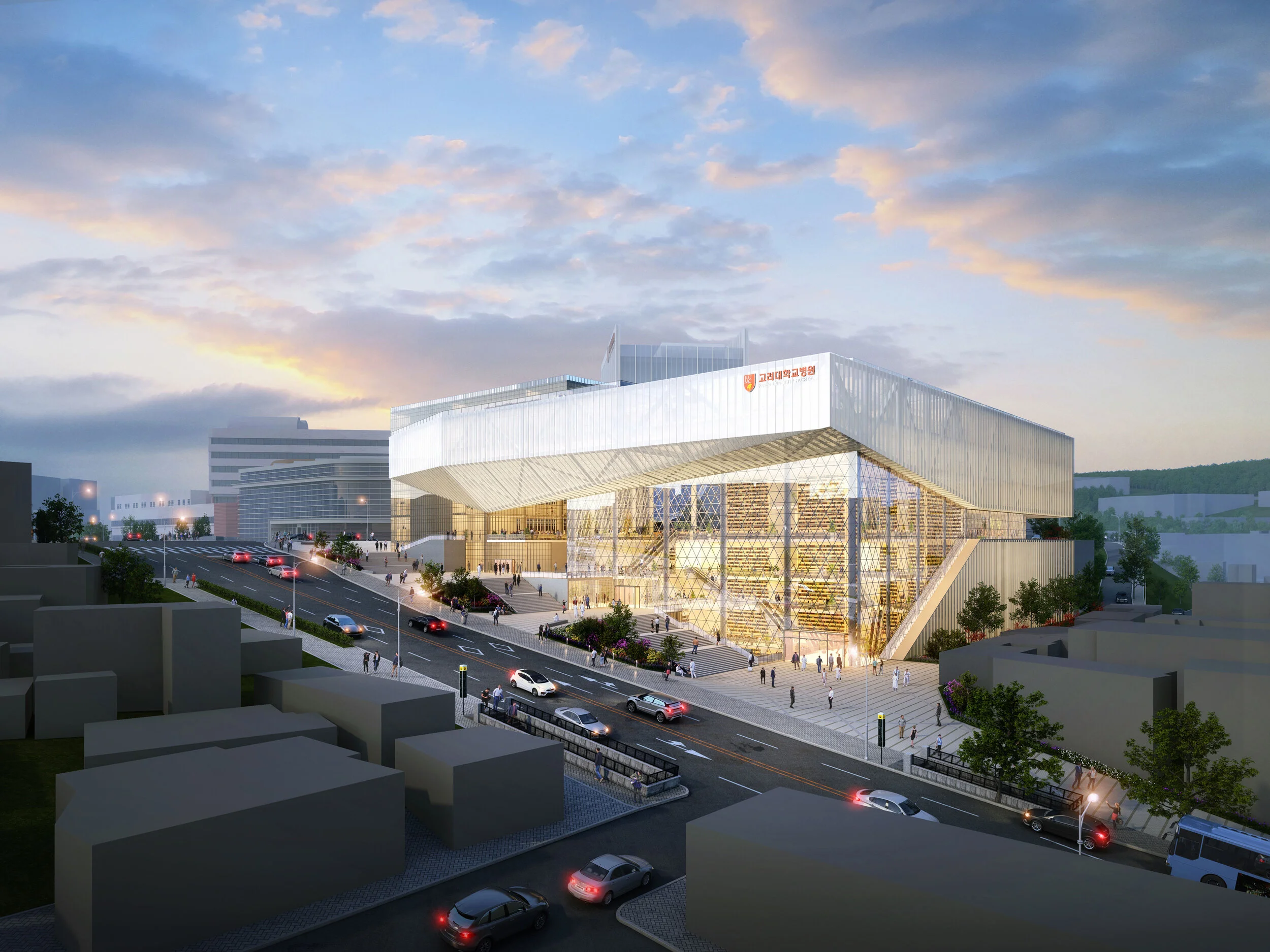
1st, 2nd, and 3rd Korea University campuses are situated around Anam Subway Station. Walking out from Exit 1 of Anam Station leads to Korea University Medicine buildings and College of Medicine campus. The project site is highly steep land. It is located in front of Korea University Medicine buildings and the center of the Korea University campus neighborhood, and it has long been used as an affiliated parking lot for the medical center.
The project is given a significant spatial role to promote the branding of Korea University Medicine and to revitalize the Korea University campus neighborhood.
The project serves three main roles as follow;
1. Defining a paradigm shift in the new role of medical facilities; expanding from illness cure to health improvement management
2. Representing the role as a landmark/gate of Korea University Medicine and the university in the neighborhood
3. Strengthening the accessibility of ambulatory patients through the direct subway connection and establishing a connection between other medical buildings
Performing these three roles, the investment of the project is planned to be recoverable within 10 years of operation.
Q-City
Resilient Medical Response | 서울도시건축비엔날레
Client: Seoul Biennale of Architecture and Urbanism Program: Medical Response System to Pandemic Location: New York City, U.S.A Team: COL.C, Soyoung Kim, Sungjin Kang, Seongeun Jeong, Youngyoon Kim, Mingyu Lee, Myeongju Ryu, Donghyuk Kang, JaeEun Lee, Hyunsoo Jang Year: 2020
The City is safe as long as the infected are properly quarantined and cared.
As the coronavirus, covid-19, spread around the world, and became a pandemic with devastating effects on national health-care systems, architects found themselves at a crossroads. Reaching 16 million cases and 630K deaths in 188 countries as of July 2020, covid-19 is highly contagious with no sight of a vaccine to this date. As the Black Plague in the 14th century in Europe had transformed the economical and social cityscape, so has covid-19. As the built environment no longer feels safe, the architectural profession needs to rethink how to live during a pandemic era and how cities can be resilient to deal with an outbreak of an unprecedented virus like covid-19.
A Q-pod, designed to be a place for quarantine for the infected individual, is an autonomous vehicle which can travel around the city on existing infrastructure.
When a person feels sick, he can call the Q-pod, which then picks him up without any human contact. After the pick-up, the Q-pod travels to a designated testing center temporarily located at existing hospitals within the city. Like a parasite, a temporary steel structure attached to existing buildings house the pods with the infected individuals.
Our project Q-City proposes an urban and architectural infrastructure, which can help control an outbreak in a city. Implementing the latest development of an autonomous vehicle technology, the self-driving Quarantine Pods (Q-Pod) travel around the city to pick up patients and transport them to health care facilities for treatments. In order to contain the pandemic, some guidelines should be established: 1_prompt quarantine of cases to avoid further spread; 2_extensive testing for early detection; 3_tracking and isolation for the infected and close contacts; 4_constant check-up and medical care for patients.
The Data Bridge
The Data Bridge | 서울도시건축비엔날레
Client: Seoul Biennale of Architecture and Urbanism Program: Hybrid Data Center Location: Seoul, Korea Team: COL.C, Soyoung Kim, Sungjin Kang, Seongeun Jeong, Youngyoon Kim, Mingyu Lee, Myeongju Ryu, Donghyuk Kang, JaeEun Lee, Hyunsoo Jang Year: 2020
With a continuous increase in data proliferation and over 15 zettabytes of data expected by 2025, data centers will continue to play a vital role in the ingestion, storage, and management of information. Often hidden from the public in a remote location, data centers are architecturally simple non-descriptive boxes. As our lifestyles and cites have become more data-driven, the more vital our data centers become. How will the future of data centers evolve and adapt to meet our changing world? How can data centers become more than just a digital factory?
SEOUL AS A DIGITALLY CONNECTED CITY
South Korea is one of the most technologically advanced and digitally connected countries in the world with constant innovations that make it a perfect place to set up a data center. South Korea has the fastest local Internet speeds in the world with almost 90% of the population having access. Seoul, the fourth-largest metropolitan economy in the world and known for its powerful and stable IT infrastructure, is an opportune location to provide connection points to both China and East Asia with low risk of natural disasters and at an affordable price compared to other markets in Asia Pacific. As a result, Seoul is seeing an increase in data center investments from global tech giants and data center providers.
NEED FOR ENERGY EFFICIENCY
Not environmentally sound or sustainable, data centers consume vast amounts of energy and have a large carbon footprint as the airline industry. Servers absorb a lot of electrical power and need to be constantly cooled down to avoid overheating problems. Nowadays companies like Google are building data centers designed to integrate the building with water cooling system instead of air cooling. It is 3,500 times more efficient than air cooling since water can be brought much closer to the heat source. Thus, there is a need to rethink how to design more sustainable centers, that will dramatically improve energy efficiency and consider renewable energy sources.
Tashkent Green Terrace
타슈켄트 그린 테라스
Client: LKH E & C Program: Residential Location: Tashkent, Uzbekistan Team: COL.C, GK Architects Status: Proposed Year: 2020
Tashkent Green Terrace is the first development phase of Tashkent Green City, a residential and commercial complex of approximately 7 ha. Based on local housing market research, it is designed to embrace the lifestyle of the residents of Tashkent and to set a new standard for contemporary living space.
The complex with terraces of various sizes and uses is planned to allow for the development of multiple unit-plan types and to create unique skylines. The streetscape and façade of the lower, middle, and upper part of the building are designed in an integrated way so that people can use the outdoor space more comfortably. The exterior space and landscaping are formed to create synergy with low-rise commercial facilities. It aims to utilize various outdoor spaces such as outdoor dining, relaxation, and community gatherings.
Tashkent Residential Characteristics Research
타슈켄트 주거 특징 및 시장 연구
Client: LKH E & C Program: Residential Research Location: Tashkent, Uzbekistan Team: COL.C, GK Architects Year: 2019
Tashkent is the capital of Uzbekistan, which benefited from the ancient Silk Road. Historically, Tashkent has been heavily influenced by Islamic culture and the federal system of the Soviet Union. This background is infused in its unique architectural culture and people's way of life. Tashkent has a Mediterranean climate with rainy seasons in winter and spring, and the year-round temperature is mild.
Analyzing the residential floor plan of Tashkent chronologically, characteristic spaces are discovered which infers patterns of the lifestyle and composition of the residential space of Tashkent locals. Influenced by the Tashkent climate, various spaces within the local house have developed as follows; side aisle with deep awning, terrace, outdoor dining area, summer kitchen, and inner courtyard. This allows outside air to breeze in, screen the sunlight, and prompt outdoor activities. The spaces in the house that represent the religious and social culture of Tashkent are as follows; a Prayer room, a space for washing hands and feet by the entrance, a spacious guest room adjacent to the entrance, a relatively long lobby, etc.
Tashkent Green City
타슈켄트 그린 시티
Client: LKH E & C Program: Masterplanning, Urban Design Location: Tashkent, Uzbekistan Team: COL.C, GK Architects Status: Proposed Year: 2019
Tashkent Green City is a 45 Ha urban development project located in the outskirt of Tashkent city. It consists of various types of residential complexes, a mega-scale shopping mall, commercial facilities, hotels, an international school, kindergartens, public facilities and parks connecting them. The project aims to build a grand park that breathes the entire complex, an urban system that enables transportation, education, and healthy and sustainable living. This will lead to a more pleasant and modern lifestyle and will contribute to the development of the Tashkent residential culture.
The complex consists of three main strips. The 1st strip is the skeleton that creates a huge park through the complex, which is intimately linked to the surrounding residential complexes, making it a delightful place for residents to visit every day. The 2nd strip connects the public open spaces within the major urban facilities in the complex. Rather than designing each public open space allocated within the major facilities, this strip integrates a series of public spaces and enables the strip to be developed in a holistic way. This embodies to establishing a distinctive identity as an urban complex and to increase the use of the facilities and open spaces. The 3rd strip is planned to support the neighboring area around the complex and to connect the surrounding area with the complex more organically. The 3rd strip, which connects two main access roads facing the complex centered the existing community center, is designed to enable local residents to visit major facilities within the complex and to communicate with new residents.
The intersection of these three strips will be created as a favorite attraction where parks, major facilities, and residential complexes meet together in the center of the complex.
Remodeling a Private Residence
Client: Private Program: Interior Design Location: Seoul, Korea Team: COL.C Status: Completed Year: 2019
Built 30 years ago, the residence features a living room with a fireplace, a bedroom with a toilet and three small rooms in similar size. The overall interior tone was finished with a variation of warm gray and white that blends with the lighting. Little darker colors are applied to one or highlight wall in each room which adds depth to space. One of the smaller rooms had its doors removed and transformed as an open-study/playroom. The built-in wardrobe is designed in two rooms, and the two bathroom cabinets are custom-designed for storage space. In particular, the client values the use and atmosphere of the lighting in the residence so the lighting can be adjusted in a multiple-way according to the use of the space such as having guests, reading books at night, or relaxing in the daytime. A different feeling of the space is created by an orchestration of tone/material of interior finish and the multiply way of lighting control. This enhances the level of comfort and responds to various uses of the space.
Shymkent New City Masterplan & Urban Design Guideline
하이빌 쉼켄트 도시디자인 가이드 라인 & 마스터플랜
Client: DONGIL CONSTRUCTION Program: Master planning, Urban Design Location: Shymkent, Kazakhstan Team: COL.C, GK Architects Status: Under Construction Year: 2019
Shymkent, located in a southern part of the Republic of Kazakhstan, is the third-most populous city in Kazakhstan. The city was built in the 12th century and it has been flourished for centuries. Now, Shymkent has been aspiring for the next quantum leap through mega-scale urban development, Shymkent New City Development. The development site is connected A-2 road, close to the Shymkent Zoo, and located in the outer part of Shymkent. Significance of historical context engraved in the Shymkent city center will continue to serve the spirit of city and locals, Shymkent New City development will deliver a new standard of pleasant & modern living. The entire development site consists of 9 rectangular districts. This proposal suggests a design guideline of 3 districts in the west-south corner.
All residential units, surrounded by four city edges, face to their own park. Responding to the four different edges of the district creates various aspects of the project. Block-type housing can develop streetscapes and courtyards with a grid system. Grid systems are carefully studied and used in this proposal to provide efficient systems, dynamic streetscapes, comfortable residential blocks, and other mixed-use buildings. A series of internal courtyards ensure the quality of life of the residents, allowing them to enjoy various outdoor activities in the front yard.
Namangan Business Complex
나망간 복합 비지니스 센터
Client: LKH E & C Program: Mixed-use Location: Namangan, Uzbekistan Team: COL.C, GK Architects Status: Proposed Year: 2019
The project site shapes long east to west and includes local sports facilities; bowling alleys, tennis courts and gym, and natural features; streams and ponds. The client asked to preserve these facilities and features within the site but required a building that had programs including city hall, business center, business school, library, and public service affair. The proposal endeavors that maintaining each program’s characteristics, how each program infused and connected are diversified. This approach generates synergies promoting between buildings, communities, and cities. The elongated podium embraces a hard edge on one side and a waterside edge on the other. The design aims to mediate two different urban fabric edges of different features. Flows that start from the other two edges pass through the building and this creates various movements, communication, and potential.
Illuminated Ground
Illuminate Ground | 새로운 광화문광장 국제설계 공모
Client: Seoul Metropolitan Government Program: Civic Plaza, Park and Culture Location: Jongno-gu, Seoul Team: COL.C, Heeyeun Yoon Year: 2019
Re-illuminate History, Re-connect Space
In Korean traditional paintings, the perception of space is conceived through the deep engagement of the space (immersed in the space) creating an experience on a spiritual level. The multiple points of view, one perceives climbing up a mountain from bottom to halfway up and to the top, is drawn/included in one single painting and describing the atmosphere, which is experienced in the landscape. This method does not follow a sequential order of capturing refined moments (of experience) in time, but creates a multidimensional layering of moments in the mind and therefore creating a painting with multi-dimensional points of view (collection of multiple perspectives in one painting). This concept of multidimensional perception of space enriches the experience of space and influences the design process of creating sceneries on the site. The landscape and the urban fabric are intersected, as well as space and time are interwoven as longitudinal and lateral threads.
The historical and architectural scenery around Gwanghwamun square shall not only exist in a single period of time but shall be constantly re-evaluated and re-composed by the citizens of Seoul for the multidimensional experience of wandering (meandering through) such as in the Korean traditional paintings. The Gwanghwamun square shall be considered in several layers of time - past, present, and future - and needs a process to question how it is made, used and be changed to find the appropriate solution.
The ‘Illuminated Ground’ focuses on the history of the ground of Gwanghwamun site to create the historical and architectural scenery. Before the Gwanghwamun square, there was the road (Yukjo-daero), and before the road, there was the soft earth of the ground of the site which embeds the multiple events and the history that has been created by. The concept of the proposal `Illuminated Ground` is to uncover and re-illuminate this `ground` to create sceneries not converging the focus to a single point nor view, but rather emphasizing the experience of meandering on multidimensional layers.
The landscape of the square acts as the mediator for connecting the ground and underground level as a park. The emptied out ‘hangrang’ space is filled with moss to act as an air filtration layer for the basement level, and the trees planted in the sunken entrance gardens are a visual mediator for the visitors to imagine an extended level underground. The convenience facilities, which comprises of the Info center on the ground level with an elevator connected down to the basement level and to the WCs and nursing areas, are placed in the two transitional zones in the park, where the site context intervene into the square and create a landscape in the park.
Column Park
Column Park | 도심 제조지역 공공미술 공모
Client: City Creation LAB Program: Public Art, Landscape Design Location: Sungsoo-dong, Seoul Team: COL.C, Yunsun Shim Year: 2016
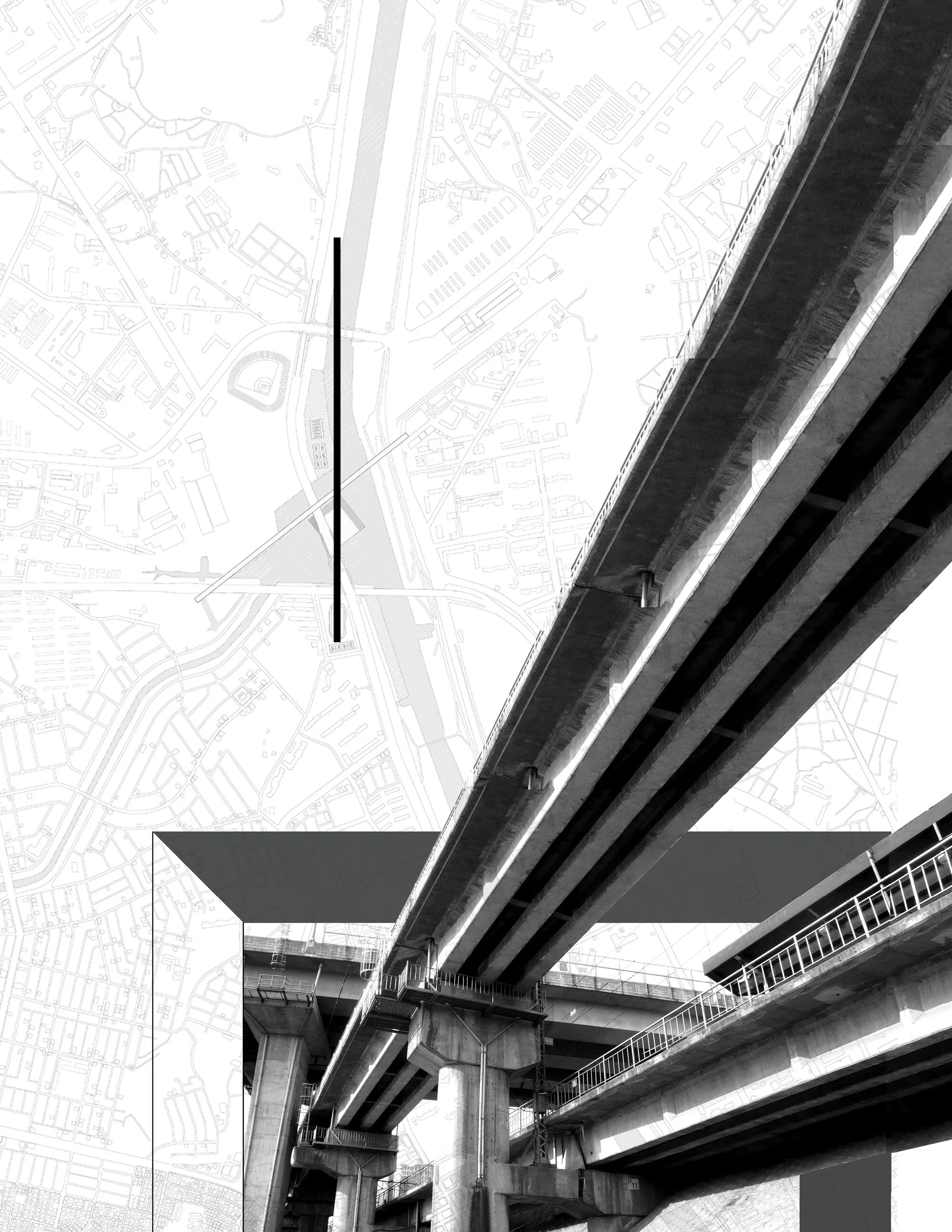
Column Park aesthetically and ecologically improves the harsh environment caused by heavy urban infrastructures such as elevated roadways and piers. Column park uses a variety of local material discarded in near semi-industrial and manufacturing areas; metal scrapped parts, pieces of leather and etc. This contributes to the local identity and saving production costs for the project.
The proposal starts by focusing on where the darkest and dirtiest part in the urban space due to the high volume of passing traffic. The space under the elevated subway lane will be transformed by the piers which support the lane above. The piers will be converted as a vertical garden to get the local community together and to support the space users in an ecological way. Column Park can be connected physically and co-operated programmatically to eco-school, bicycle road, green area, and other public realms which are one of the Seoul City Regeneration Demonstration projects in Ttukseom Station Area.
The place will support a variety of activities that happens in different time zones; day / night and weekday / weekend. It helps to mitigate the heat island phenomenon, purify the air around roads and contribute to ecosystem diversity.
Re : Node
Re:Node | 도심 제조지역 공공미술 공모
Client: City Creation LAB Program: Public Space Design Location: Sungsoo-dong, Seoul Team: COL.C, Yunsun Shim Year: 2016
This proposal aims to improve the condition of the streets that have been indiscriminately developed around a Node*. The Node is a major hub of creating new public spaces by generated the locality of this area. To this end, the proposal defines a critical Node where the roads intersect major public spaces in Sungsu-dong and where residents and visitors can naturally hang out and interact, not just roundabouts or intersections passing through them. Using most of the elements that make up an existing street (building facade, pedestrian crossing, bicycle racks, sidewalk pavement, street furniture, and street trees), the proposal reconfigure multi-layered urban fabric. Gradually, the redefined nodes will be more discovered and connected in this neighborhood. This leads to strengthening the holistic local identity of Sungsu-dong where diversity and creativity is welcomed.
*Node; strategic focus points for orientation like squares and junctions (Kevin Lynch, 1960)
Airport City, Navi Mumbai
Aero-polis as Leveraged Civic Aspiration
Airports are a major infrastructure that has an important urban role. They act as symbols for local civic aspiration, as well as a hub for global communities. Yet, the locations of airports tend to be distanced from city centers, often resulting in a separation of the city from the airport and prolonged travel times for passengers, as well as a high cost to establish infrastructures connected to the city center.
This project was developed in response to the above observation and based on the following ambitions; How civic aspiration for speculative development can be orchestrated as urban dynamics through a social frame; How the business district can be configured via direct connections to the international airport, and; How the international airport can be an urban success and introduces local culture to international travelers.
The project seeks to introduce urban activities by:
1) incorporating the existing hills with the new waterfront community thereby creating different nodes and neighborhoods within the city;
2) The integration of three-dimensional land-use planning to maximize the possibility of the program mixture, and
3) The creation of a range of programs and experiences within 10 minutes walkable distance in 10 blocks composed of organizing building blocks and land use
Through these three approaches, the Airport City becomes a mixture of aesthetics and an imposing mega-infrastructure that functions as an Indian cultural hub formed by multi-dimensional topography.
Extravert Courtyards
Istanbul, Between Contour and Silhouette
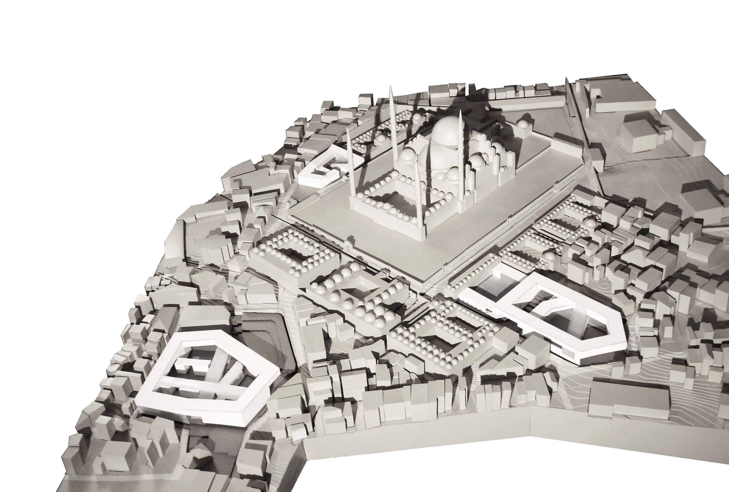
The three given project sites are located around the complex of the Süleymaniye Mosque. The mosque delineates a distinctive silhouette situated on top of one of the hills that comprise Istanbul’s “Golden Horn”. These hills are a fundamental element in defining the panoramic character of the city’s urban fabric.
The mosque is a religiously sacred realm that has front- and backyards around the buildings. These semi-public yards serve as buffer zones at the transition point where worshippers enter from the mundane world to the sacred realm. This is a reason why it represents a large figure of the urban fabric and the constraint of certain activities. In addition, most urban activities happen in the meandering streets and semi-private courtyards in blocks near the mosque.
To encourage urban dynamics through establishing a platform of public domain, a series of courtyards have been introduced within the three project sites. The designed courtyards and open spaces create a new inner silhouette and mediate steep contour levels to enhance accessibility from the outside. A closely related series of courtyards
allow people to have a glimpse of nearby courtyards stimulating visitors’ curiosities. This approach provides an unexpected urban encounter such as a labyrinth-oriented experience.
A set of courtyards introduces a micro-scale of the urban fabric, orchestrated within the existing historic urban fabric.
Verticalscape, Chicago
Hybrid of Two Negative Urban Infrastructures
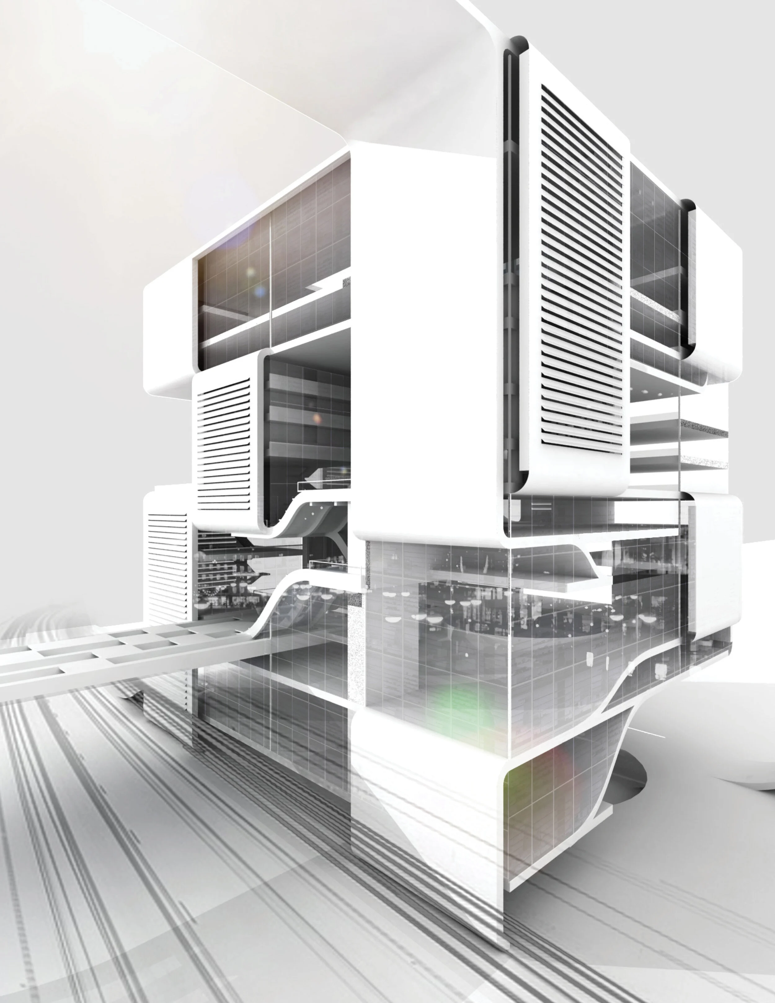
Negative urban infrastructure tends to be alienated from the city center due to its unpleasurable and imposing appearance. As a wastewater treatment plant, this essential infrastructure serving an entire city is considered a negative aspect of the urban environment which brings the NIMBY effect from adjacent neighborhoods. Moreover, due to its disoriented location, the infrastructure loses its efficiency as it travels around the city. To increase the efficiency of the infrastructure and raise public awareness of urban sustainability, two neglected urban domains, wastewater treatment system, and mental rehabilitation, are combined into one. The result is located at the edge of the Chicago River.
These two domains are highly related through the way in which the water travels and is treated in the metropolitan region. The hybrid building demonstrates the process from clean water to black water and the purifying system from used water to freshwater. Through exposing the entire water treatment system within the building, different forms of water are incorporated into space and utilized in the rehabilitation program as a form of mental therapy.
Ultimately, the hybrid of the negative urban infrastructure creates a new type of public domain that enhances community health and urban sustainability.
From Dead End to Flow
Willets Point and Corona Park
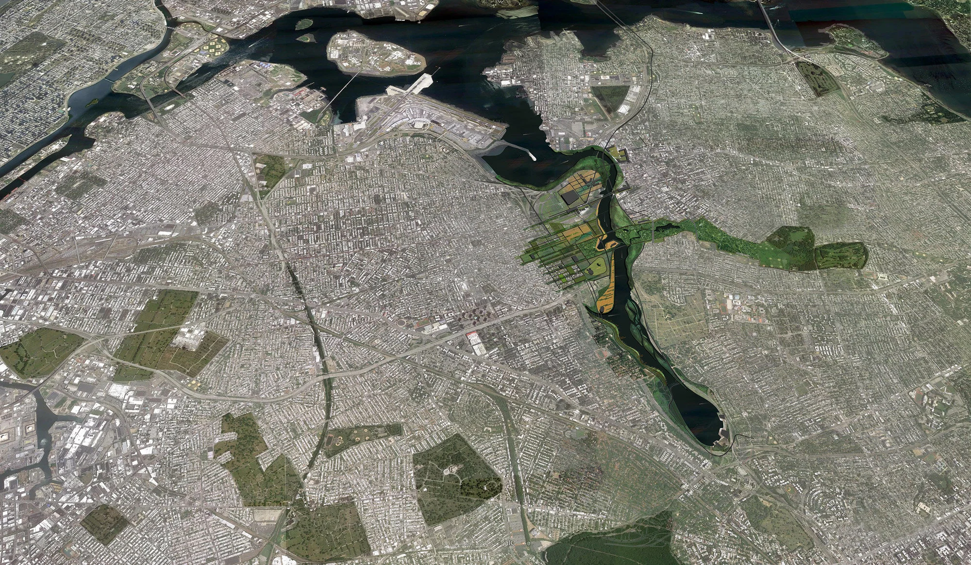
Willets Point, together with Corona Park to the north of it, is located at the center of Queens, where different kinds of industries and communities meet. However, due to the complicated site conditions resulting from heavy infrastructure, inaccessible open spaces and fragmentary developed programs, Willets Point and Corona Park have become a dead-end for pedestrian flow, vehicles, and open space.
We have discovered the following elements to be the primary causes of the dysfunctional areas. Firstly, the site is segregated by heavy infrastructures including the number 7 subway line, Van Wyck Expressway, Grand Central Parkway, Long Island Railway and their junctions. Secondly, open space within the site lacks program diversity of different scales. Thirdly, scattered public facilities are not operated as an access network to serve communities of different levels such as local, borough, regional and national. Fourthly, water resources cannot be used properly to serve the recreational function because of the following reasons: a) contamination caused by industries around the estuarine area; b) the previous reclamation that damages the drainage system; c) inaccessible water edge blocked by heavy infrastructure.
Sky Well
Public Catholic Cemetery Redevelopment
The project is a redevelopment of the old Catholic public cemetery, located on the outskirts of Seoul. Since public cemeteries are mostly considered as a negative contribution to the public realm and the property value in the city center is too high to have space for the deceased, in the case of Korea they have always been located in suburban areas of metropolitan regions. For this reason, rather than properly commemorating the memory of beloved people, many public cemeteries tend to be abandoned spaces and deserted unpleasurable public domains.
The fundamental idea arose from the question of how unattractive public cemeteries can be transformed to be commemorative places filled with private meditation and reminiscence. When people have to face the agony of death, nature can be appreciated through ritual events. Landscape design can influence peoples’ movement and emotion through a transformation of the way they experience certain spaces.
Sky Well is the culmination of an explosive emotional moment meeting the climax of the ritual movement. The project consists of a charnel house, crematorium, different types of crypts and chapels in one of the hills facing the Han River confluence. The landscape features have dramatic aesthetic features, enhancing how people discover different perspectives throughout their unique journey within the cemetery. The architecture of the buildings is incorporated to flow with the existing landscape to allow people to reflect on their memories of their beloved ones. The moment one faces the eternal farewell is orchestrated through appreciation of both nature and human experience.
Dynamic Balance
To challenge the stereotype of a suspension bridge, an imaginary site with extreme project scenarios is given. The project deals with designing a bridge connecting two sides of a cliff that is constantly exposed to the wild gusting sea winds. Imposed upon the design will be the condition that there is no possibility of a detour. Furthermore, the following rules will be adhered to:
1. As breaking bedrock is extremely hard, digging through cliff costs too much and no tunnel will be built.
2. As the submarine bedrock is too deep to build a pier and vulnerable to intermittent seismic attacks, slabs will not be supported by any pier coming from the deep sea.
3. Design a solution for slab buckling which is potentially caused by the continuous strong wind.
4. Maximize the appreciation and experience of the surrounding dramatic landscape.
.
Regeneration of Festivals
Gwangju Asia Culture Complex
The given site represents the spirit of protest for democracy in modern Korean history and is marked by the occurrence of genocide. The place has been considered a sacred realm for the deceased protesters. However, the government decided to transform this historic site into a new Asian Cultural Complex which is to serve as an anchor for downtown revitalization.
This proposal is based on three premises: the place can be celebrated by public activities, space can be generated by a continuous flow rather than a hierarchical spatial organization, and the architecture represents the spirit of democracy.
Firstly, to decentralize the flow of the public and to generate multi-nuclear communities at the site, a series of stacked layers is introduced. Each layer functions as an essential infrastructural component of a small village, including waterways, roads, and open space. Next, light wells intervene with the stacked layers. This intervention deconstructs the conventional idea of stacking floors into a building; it allows for free interaction at unexpected spots and introduces a blurred interior space, defined by an absence of some surrounding walls.The designed platform will foster dynamics among users, introduce new ways to experience both space and authentic local culture, and most importantly it will remind present-day visitors of the history of the protesters.
Urban Waterfall
In highly populated and dense areas in city centers, amenities for the public benefit tend to be deprioritized due to high property values. It is difficult for city dwellers to experience nature in their daily lives and people often travel great distances to find wilderness. The intention of the project is to implant a natural setting within the brutal concrete jungle in order to create a refreshing urban amenity.
The installation consists of a waterfall off the top of a building. By casting a waterfall from the top, people can take a rest inside the actual installation and feel and watch the water drop while looking out. The water’s downward movement allows it to interact with multiple settings of this project. The motion generates waterfalls, healing saunas, water screens, streams, wetlands and mud ponds. Because water permeates the site and takes on many roles, through its circulations form follows function.
This Installation could be implanted in different leftover spaces in urban environments such as deserted parking lots, dead space under massive infrastructure, and dark spaces in between high-rise.
Field of Collision
Speculations and Alternative Futures, Mumbai and Navi Mumbai
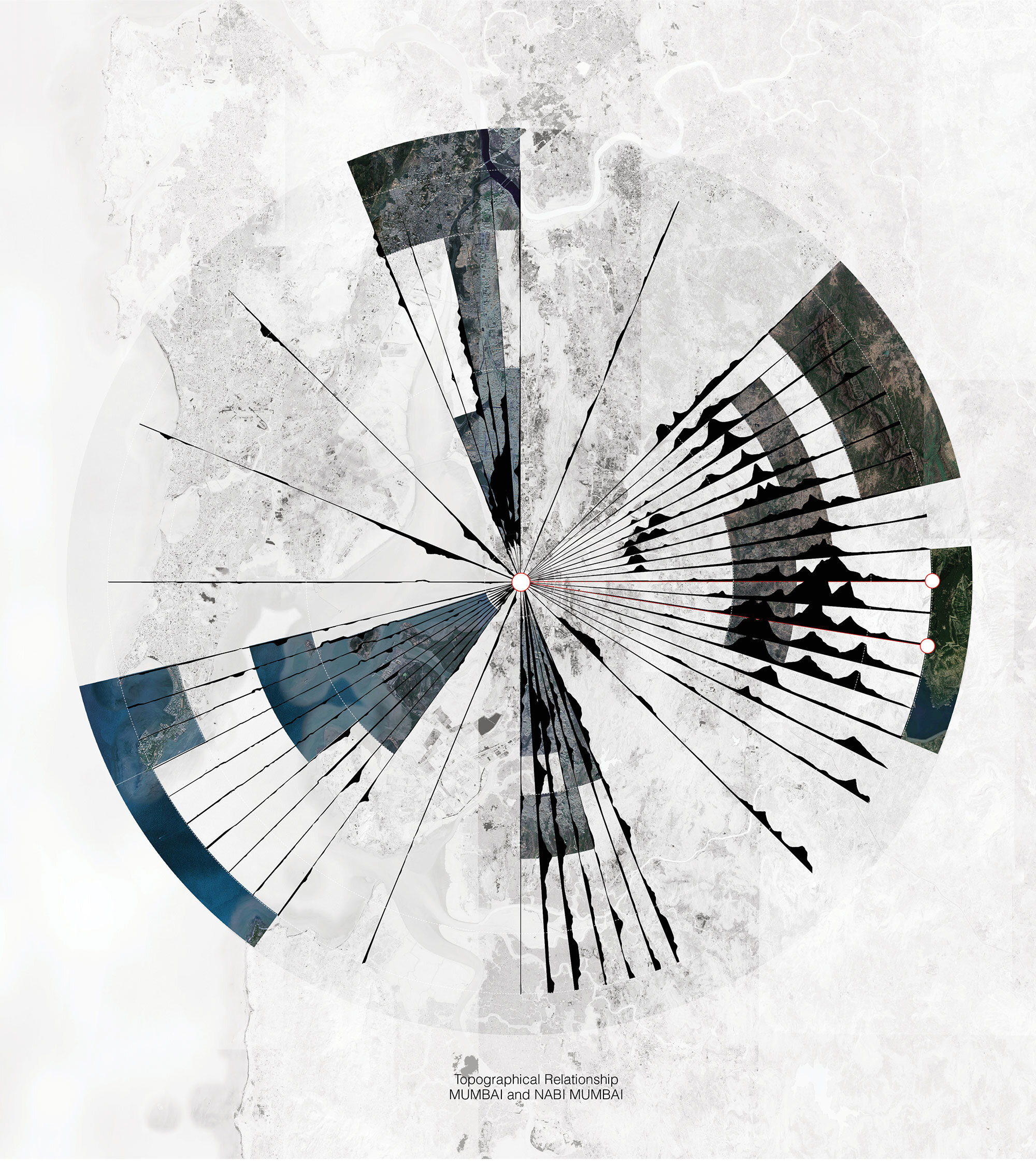
The research considers the question of where the New Mumbai International Airport Development (NMIA) is to be built. The NMIA will fulfill a key role in the organizational structure for New Mumbai city. The goal of the research is to define the feasibility of the new airport development and the environmental impact on the site.
Firstly, mapping the historical urbanization of Mumbai illustrates that the Old Mumbai city capacity has reached the saturation point along the North-South “development” axis and that upcoming urbanization and speculated development is expected along the East-West “expansion” axis. This shows that New Mumbai urban development is a response not only to economic development but also to the civic aspiration for better urban lives. In addition to this, the NMIA aims to be competitive with major European airports such as the Charles de Gaulle Airport located near Paris and thus the scale of development needs to be chosen accordingly.
Secondly, research on the mangrove system around the project site suggests that the Mumbai metropolitan ecology system requires reconfiguration as the NMIA development impacts the existing ecological system significantly. The radial transect of the area (radius 30km) clarifies that the project site is situated on the bottleneck of the entire watershed east of the site. The site is both an urban expansion point as well as an ecologically vulnerable area.
Finally, one tributary has been highlighted to study exactly how the water edge is affected by urbanization. The shape of the water can be transformed and shifted by major infrastructure and urbanization.
Exploring the Design Potentials of Grids
Exploring the Vertical Hybrid of Urban Grid, Infrastructure and Pedestrian Network
Highways and large scale infrastructure have been accused of being the factor that separates existing urban fabric, leaving disconnected and leftover spaces. However, nowadays, the urban grid as the basic urban network is no longer a simple single-layered system. Elevated structures, as well as underground development, have generated a more complicated multi-layered urban system. We are interested in this new kind of gridded landscape (in particular the pedestrian-scaled network) and how it works with the existing urban fabric. In order to draw our final conclusion of how to make the multi-layered gridded system work with the existing urban grid, we consider four case studies that are used to define solutions and clarify problems.
The advantage of a layered gridded city network is that it separates different urban systems for different scales of activities. Multiplying the layers of spaces not only increases complexity but also enhances the prosperity of a specific urban space. However, the city does not benefit from operating with totally separated systems, so for a successful hybrid and multi-layered urban project it is necessary that all layers are well connected and inter-related, especially interacting with the existing urban grid, so as to facilitate an easy transition between different spaces. As a result, this hybrid space network is an ultimate integration of the vertical layered urban structure into the gridded urban space.
Suburban Nature of Queens
Mapping Queens
When distinguishing between urban and suburban areas, suburban refers to subordinate bed towns or satellite cities which mostly function to support its main urban center. The research starts from this premise. What is the role/function of suburban areas that have no supporting function for its main cities? Is it just abandoned space that is too far away to be connected to its center? Or is it a decaying place which has not been developed due to its own inherent land constraints?
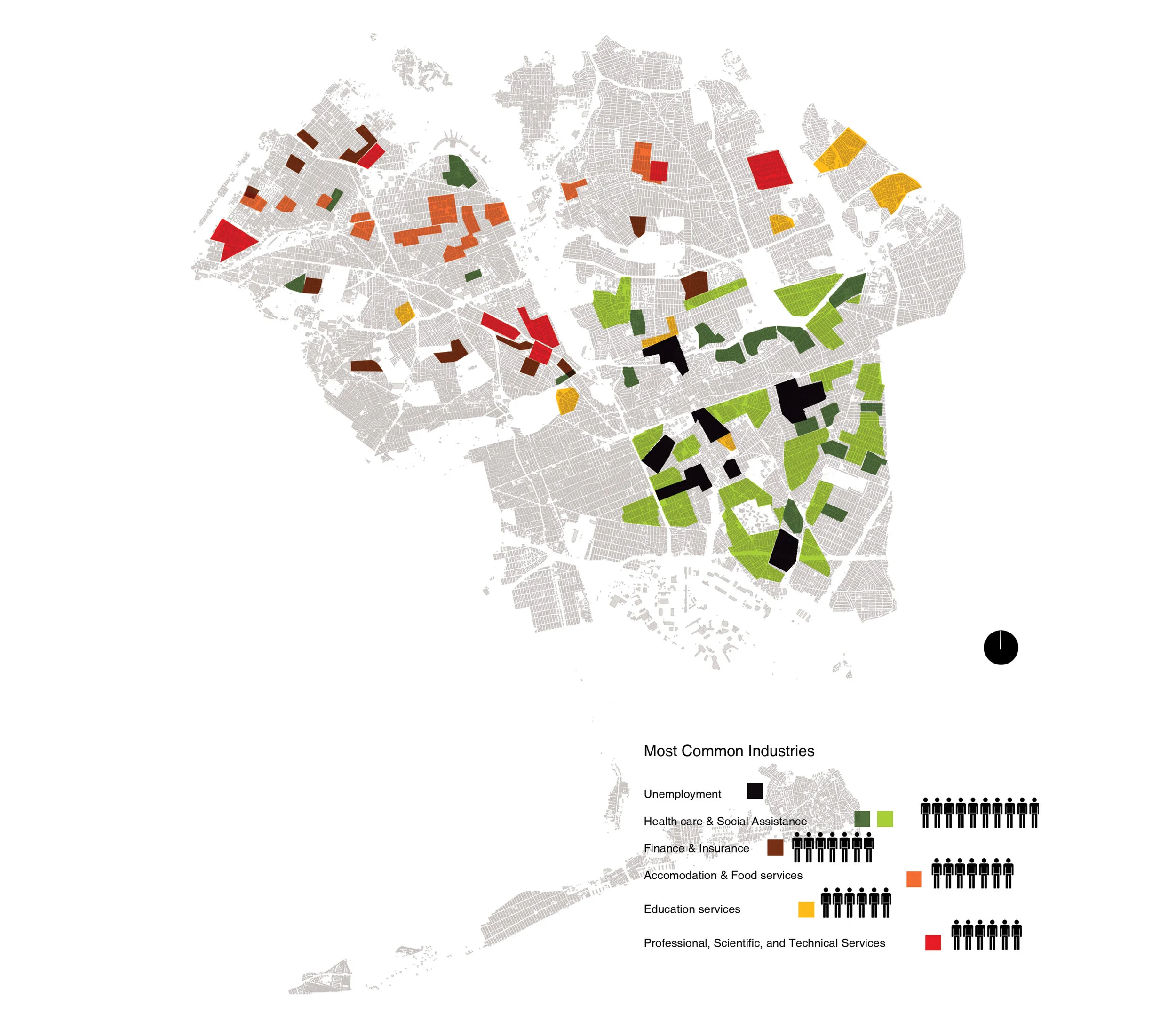
This research takes the relationship between Queens and Manhattan as an example. What is the function of the part of Queens that is unrelated to Manhattan? The first step of the research is identifying the physical infrastructure connecting Manhattan to Queens and delineating how big the portion of Queens supporting Manhattan is.
The second step is mapping the workers and industries of Queens. How many of the residents of Queens work in Manhattan? What kind of jobs do the residents of Queens hold and where exactly are these jobs located?
MIXINFRA x PROGRMAX
Han River and Dongjak Station
500km long and 1.2km wide, Han River divides Seoul into north and south.
Han River, which acts as a dominant barrier, has influenced the creation of prominent infrastructures: Riverside Northern Highway in northern Seoul, 88 Olympic Highway in southern Seoul, and 20 bridges along Han River that connect the whole of Seoul.
Infrastructure creates isolation.
Although infrastructure was designed to connect places, in Seoul, most infrastructures create a division between and neglect nearby spaces, presenting critical issues in communication.
MAXMIX.
Moderating Hierarchy Mixing of infrastructures and programs, classified in terms of hierarchy, is maximized. It draws consistent and fluid connectivity, allowing integral regeneration of isolated regions.
Dongjak Station, the Critical Place
The project site is Dongjak Station region, subway line 4, currently in redevelopment with line 9. This zone consists of Dongjak Grand Bridge, Dongjak Station line 4 and 9, 88 Olympic Highway, Banpo Creek, HyunChoong Road, Dongjak Parking lot, and an enormous green space nearby, Seoul National Cemetery. This now-abandoned area will provide an appropriate prototype for all the divided districts through Maxmix.
Reforming Infrastructure, Renewing Programmed Place This proposal suggests three mixed zones with transit transfer centers; the integration of Transit Transfer Center and Retail Arcade on Dongjak Bridge, the Market and Agriculture Alternative School on the existing parking lot, and Government Office and Public Leisure Space at the riverside. These zones will be connected by pedestrian walkways and transit networks. Dongjak Station will be a vibrant community with various activities that unifies an integral, characterized place.
Immeuble Cité
The Linear City in Guro of Seoul and Kwang-Myeong of Gyeong-Gi
The purpose of this workshop is to reunite urbanism and architecture as one singular and synthetic approach. Our team interprets “Immeuble Cite” as an entity with the integrity of cityness, which fulfills the community for people.
The project site is located on the border of two big cities - specifically at the outskirt of Seoul and nearby Gyeong-Gi province. In regards to the circumstances of the project site, there are many heavy infra-structures which provide connections between Seoul and Gyeong-Gi province. Our team researched part of the area across Guro in Seoul and Gwang-myong in Gyeong-Gi province. We figured out that there is a critical spot to both resolve the problem in the area and represent our idea very clearly. The project site is divided by many heavy infra-structures, 1 river and 2 streams. As a result, it has become like the debris of land. Furthermore, the heavy infra-structures and streams are all elevated. This geographical condition ultimately creates too many dark, dead and isolated spaces between each infra-structure over the area. Also, there are many reservoirs to control the water level during the rainy season in summer. These reservoirs are isolated from various people’s activities and they are not used as public spaces properly.
The purpose of this project is, therefore to define a city which connects all the divided area and to acquire centrality of this region, while implying 3 concepts: Unification, Connection, and Centrality.
Firstly, Unification will be materialized as a linear and tall mass. This mass contains all kinds of people’s activities and carries various functions to the city while providing a transition between different land conditions.
It will be a size of 20m (thickness), 1200m (length), and 50 stories high(height). The ‘Immeuble cite’ could achieve what is believed to be integrity as an entity of the city. We named it ‘The Linear city’.
Life is Matchpoint
A House for Two Artists
Life is a series of individual traces, accumulated with countless encounters and choices. To celebrate unexpected encounters, the house is designed for intended coincident encounters of two people’s lives. The premise is that an artist, Jackson Pollock, and a movie director, Woody Allen, share a house. Furthermore, the residence for each of the individuals reflects their life philosophy and allows them to create dynamism by their encounters.
There are two parallel lines that never meet each other in one rectangular area. These parallel lines mark the two residences. The two artists share the space between the parallel lines as a ‘Mirror Space’. The Mirror Space can be an entrance, a meeting place, and a separating boundary at the same time. The Mirror Space shows the reinterpretation of space from Allen’s movies and Pollock’s paintings. There are ‘Light Wells’ across the ‘Mirror Space’ and these light wells connect individual houses in the different forms. In Allen’s residence, the light wells act as fragmented slabs at multiple levels, and the random light traces from the light wells are situated on the wall of Pollack’s residence just like one of his action paintings.
The result is that the two artists face one another’s life from the reflection of the Mirror Space. The Mirror Space creates a spontaneous encounter through the medium which reflects both oneself and another at the same time.
Daydreaming Sea
Water Leisure Complex Redevelopment
The distinctive natural features of Busan are its many hills and beaches. There is a small deserted port nearby Gwanganli Beach which is well-known as a summer vacation destination in Korea. The port is located at the outlet of the river into Gwangli Beach. Around the area, there are several public facilities including a museum, theater and yacht racing port. However, these buildings are disconnected, lacking both pedestrian ways and public open space due to the high volume of road traffic in the area. In order to foster the integration of this area into a unified cultural complex, the port becomes a public water sports complex.
The flow of the river is redirected into the complex to engage fragmented leftover outdoor spaces around the area. To enhance pedestrian approaches, a new overpass deck is introduced to connect the separated areas. This is a starting point to establish a cultural belt of Busan that takes into account the local citizen’s authentic culture and caters for distinctive tourism.
The reinforced waterfront, retrofitted pedestrian paths, and water flows allow for citizens to appreciate environmental assets and increased public engagement.

